

-
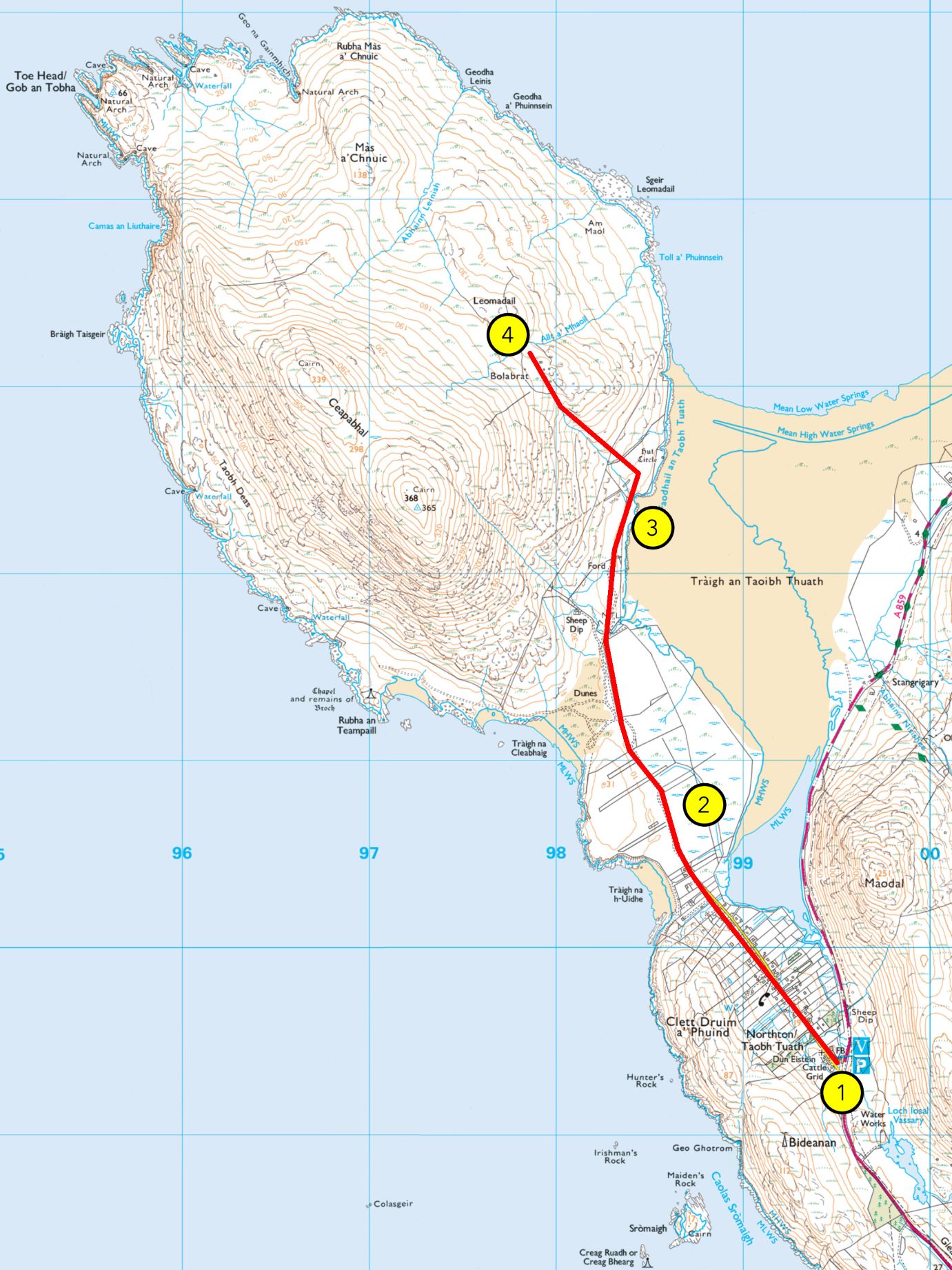
WALK 4: TRÀIGH AN TAOIBH THUATH
From Hebrides People Visitor Centre to Tràigh an Taoibh Thuath Grade: A (A+ if extanding to Bolabrat) Length: 4.5 miles/7km, about 1.5 hours Terrain: vehicular road, then a gravel path, machair/grassland, sand and moorland Wildlife: sea eagles, moorland birds like meadow pipit, stonechat, red grouse, wheatear and wrens, coastal birds like lapwing,…
-
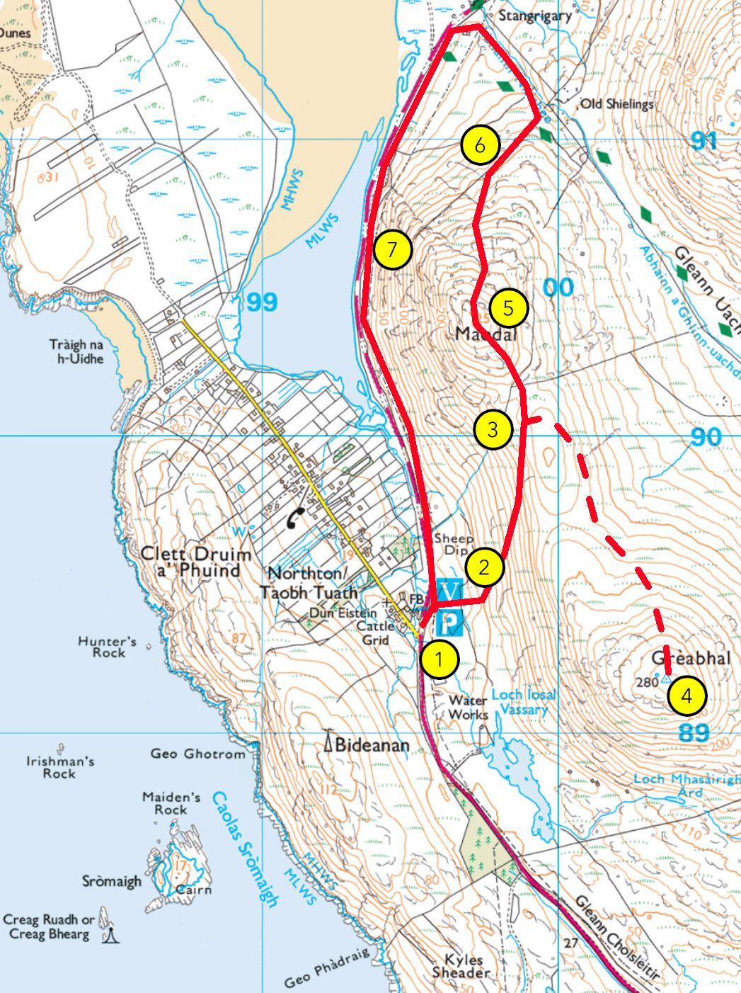
WALK 3: MAODAL (AND GREABHAL)
From Hebrides People Visitor Centre to Maodal (and Greabhal) Grade: B Length: 3 miles (or 4 miles) / 4.5 km (or 6km), between 1.5 hours / 2.5 hours Terrain: vehicular road, moorland, peatland bog and steep rocky hillside Wildlife: golden eagles, moorland birds like meadow pipit, stonechat, red grouse, wheatear, wrens and others, wetland birds…
-
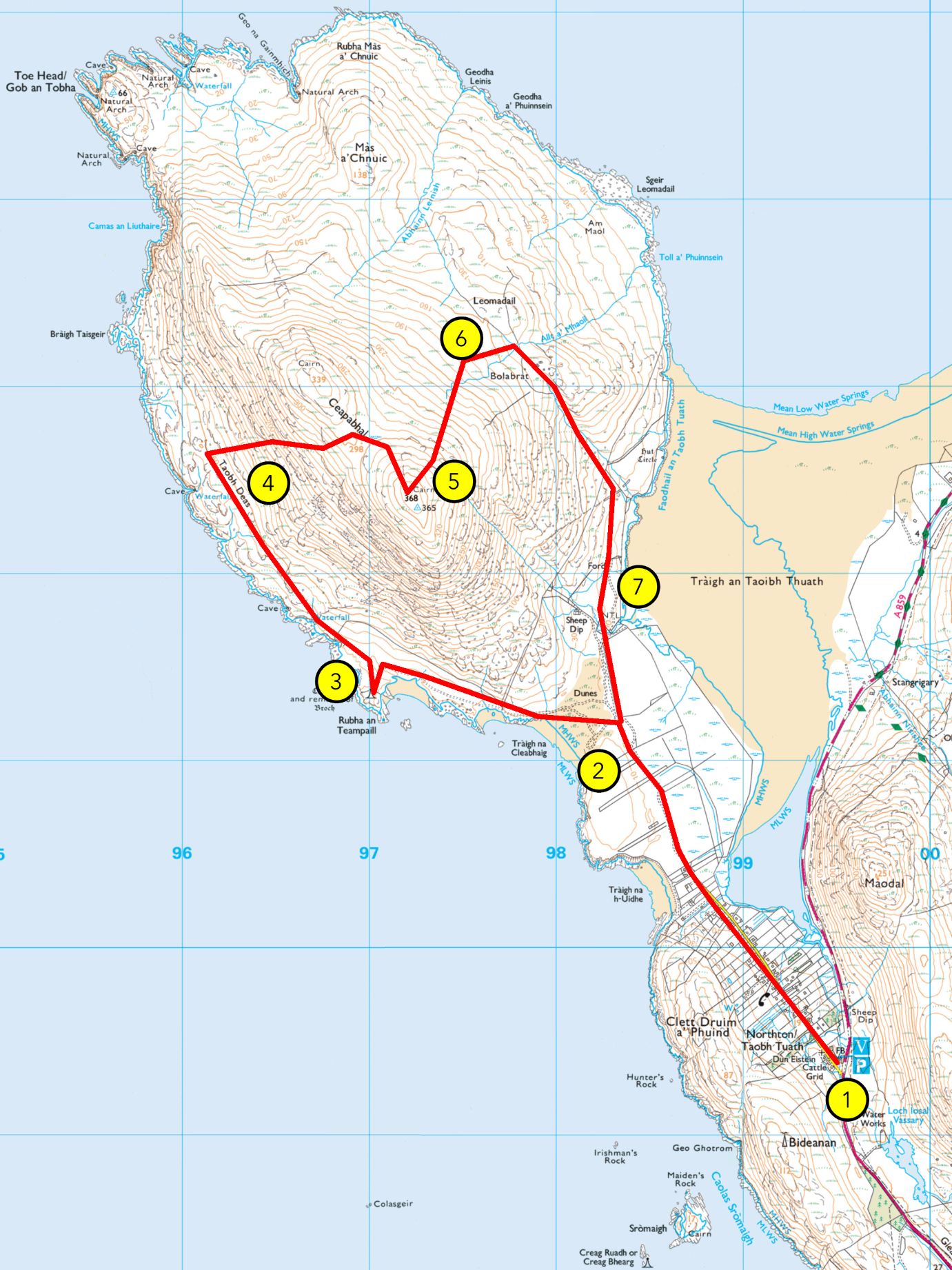
WALK 2: CEAPABHAL CIRCULAR
From Hebrides People Visitor Centre to Ceapabhal summit Grade: C Length: 7.5 miles/12km, about 4 hours Terrain: vehicular road, gravel path, machair, grassland, sand, peatland bog, moorland and steep rocky hillside Wildlife: moorland birds including meadow pipit, stonechat, red grouse, wheatear, wrens and golden eagles, coastal birds like sea eagles, lapwing, greylag geese, kittiwake,…
-
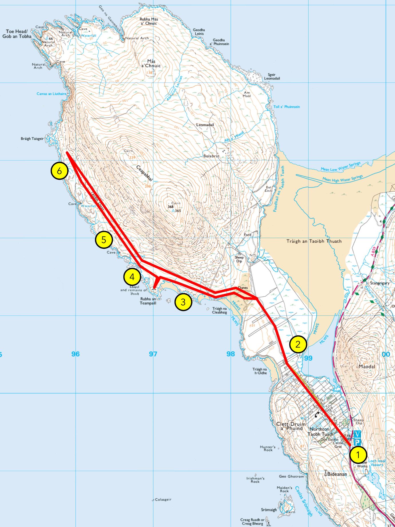
WALK 1: AN TEAMPALL AND AN TAOBH DEAS
From Hebrides People Visitor Centre an Teampall (and Bràigh Taisgeir) Grade: B (A if stopping at an Teampall) Length: 7 miles (4.5 miles) /11km (7km), about 3 hours (2 hours) Terrain: vehicular road, gravel path, machair/grassland, sand, peatland bog and moorland Plants: red and white clover, daisies, buttercups, bird’s-foot-trefoil, orchids, sea pink, ragged robin, harebell, marram grass, sand…
-

Board Recruitment – Now Open
In case you missed it, we have recently launched the application process for joining the Northton Heritage Trust Board. This is an exciting opportunity to help shape the future of the Trust and support our work for the benefit of the community. Full details about the role, along with the application form, can be found…
-

HMS Bulwark
On Thursday morning, on the 26th of November 1914, the Royal Navy battleship HMS Bulwark was moored at No. 17 buoy at Kethole Reach in the River Medway, in the south east of England, about four and a half miles west of Sheerness, having been transferred from the south coast of England in anticipation of…
-

Join Our Board – Volunteer Opportunity
Northton Heritage Trust is seeking new Volunteer Board Members to help shape the future of the Hebrides People Visitor Centre. If you’re passionate about heritage and community, we’d love to hear from you. Meetings are monthly (online or in person), and all backgrounds are welcome.To express interest, email info@hebridespeople.com.
-

Discover the Legends of the Outer Hebrides: Second Choice
Welcome back to our fortnightly journey through the Hebrides, where we adapt tales from Bill Lawson’s ‘In History and Legend Series’ to bring you stories of adventure, romance and the enduring spirit of island life. Each post uncovers the legends that shaped communities and the choices that defined destinies. Second Choice Iain Macualy was from…
-

Discover the Legends of the Outer Hebrides: Stowaway
Step into the heart of the Hebrides with our adaptations from Bill Lawson’s History and Legend Series—where every week we bring you a fresh tale of adventure, resilience, and island spirit. Discover the stories that shaped a community!
-
Uncover Your Family’s Legacy This Christmas – Limited Time Offer
Discover the extraordinary gift of your ancestry, traced back—often to the mid-1700s. Discover the extraordinary gift of your ancestry, traced back usually to the mid 1700s. Our expert research work, building on over 60 years of work by Bill Lawson, ensures the precision and depth of your family history. We carefully bring together oral tradition…

Make a Donation
All donations will go towards the running of Hebrides People so that we can preserve the genealogical history of the Outer Hebrides from Lewis to Barra.

Open Monday – Thursday 10am – 3pm
Contact Us
admin

Explore the St Kilda archive for free
Thanks to the Heritage Lottery Fund, all database results for St Kilda are free. Visit the St Kilda archive to see how the database works!