-
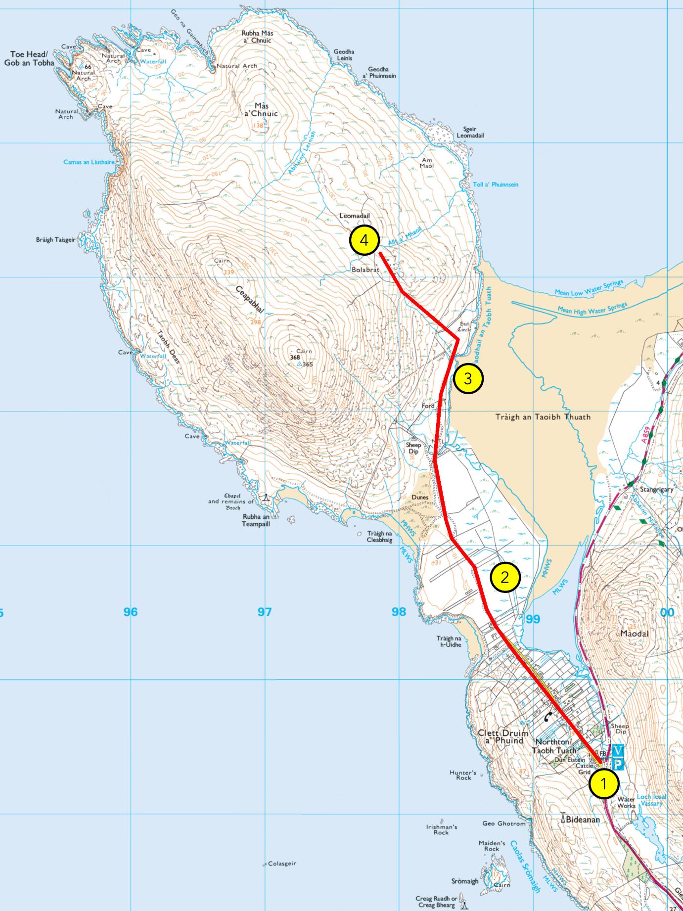
WALK 4: TRÀIGH AN TAOIBH THUATH
From Hebrides People Visitor Centre to Tràigh an Taoibh Thuath Grade: A (A+ if extanding to Bolabrat) Length: 4.5 miles/7km, about 1.5 hours Terrain: vehicular road, then a gravel path, machair/grassland, sand and moorland Wildlife: sea eagles, moorland birds like meadow pipit, stonechat, red grouse, wheatear and wrens, coastal birds like lapwing,
-
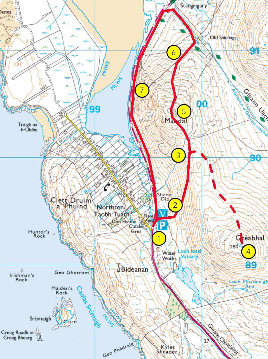
WALK 3: MAODAL (AND GREABHAL)
From Hebrides People Visitor Centre to Maodal (and Greabhal) Grade: B Length: 3 miles (or 4 miles) / 4.5 km (or 6km), between 1.5 hours / 2.5 hours Terrain: vehicular road, moorland, peatland bog and steep rocky hillside Wildlife: golden eagles, moorland birds like meadow pipit, stonechat, red grouse, wheatear, wrens and others, wetland birds
-
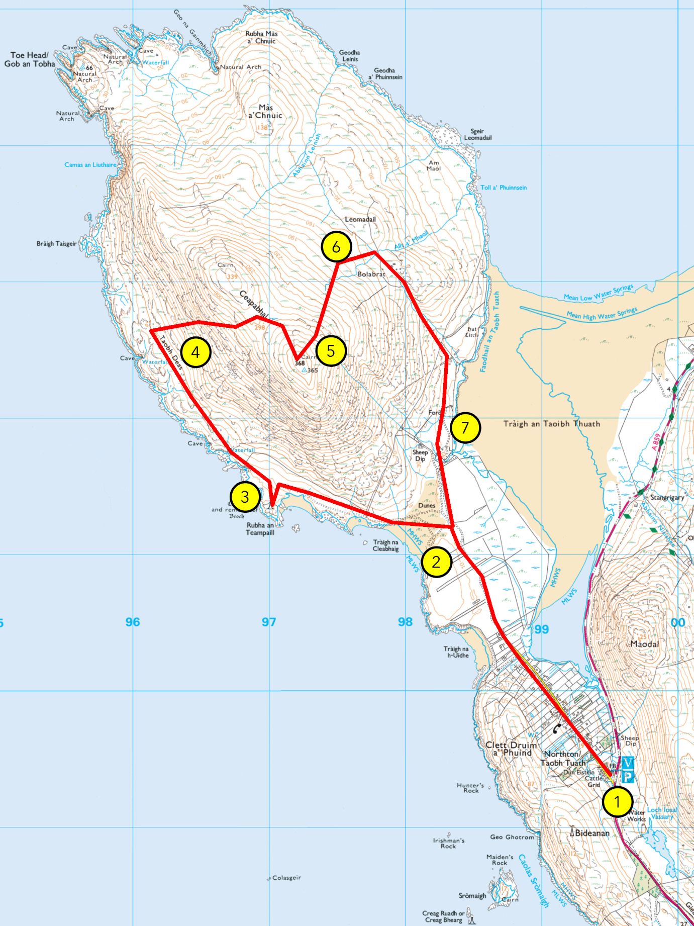
WALK 2: CEAPABHAL CIRCULAR
From Hebrides People Visitor Centre to Ceapabhal summit Grade: C Length: 7.5 miles/12km, about 4 hours Terrain: vehicular road, gravel path, machair, grassland, sand, peatland bog, moorland and steep rocky hillside Wildlife: moorland birds including meadow pipit, stonechat, red grouse, wheatear, wrens and golden eagles, coastal birds like sea eagles, lapwing, greylag geese, kittiwake,
-
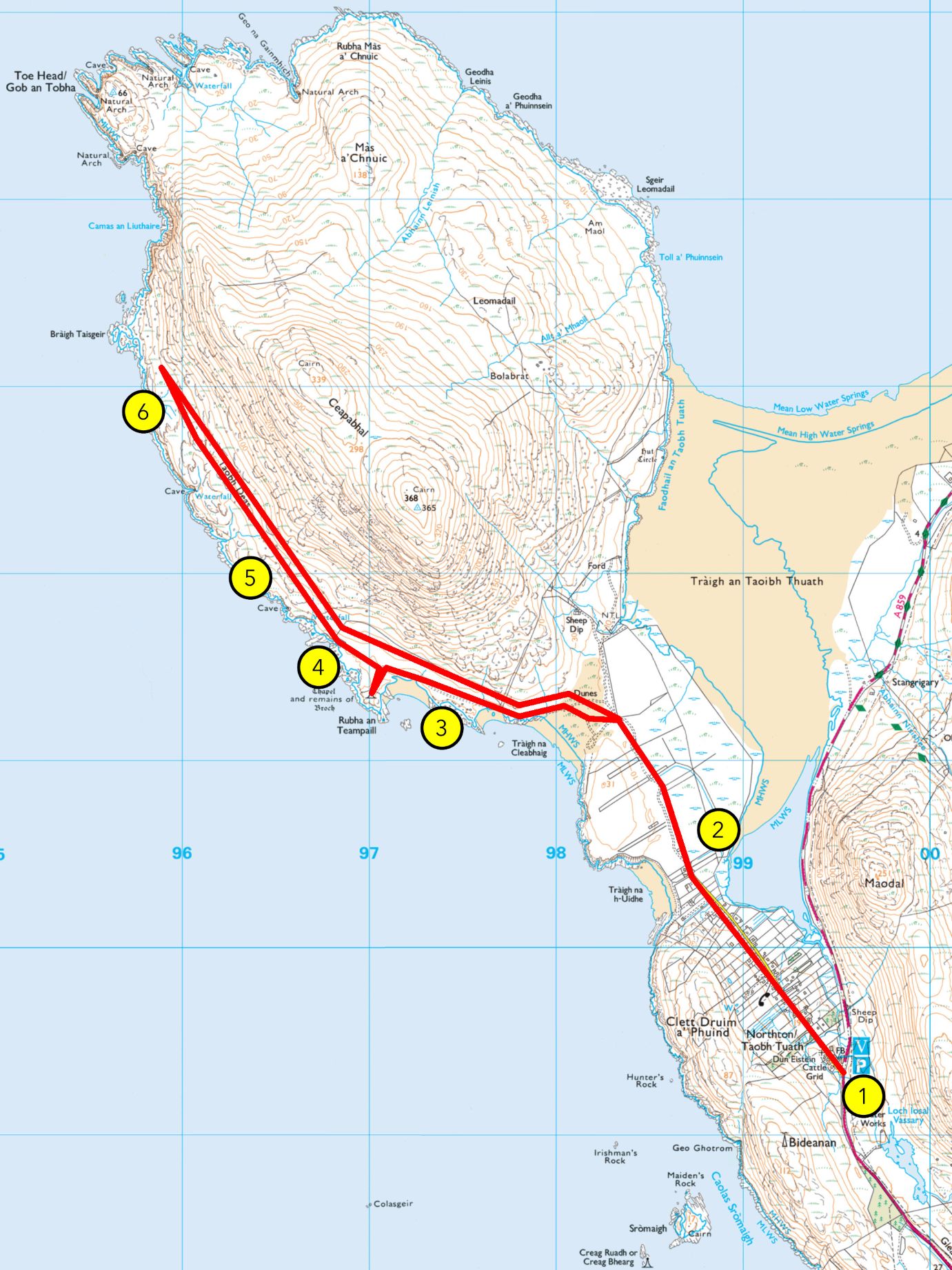
WALK 1: AN TEAMPALL AND AN TAOBH DEAS
From Hebrides People Visitor Centre an Teampall (and Bràigh Taisgeir) Grade: B (A if stopping at an Teampall) Length: 7 miles (4.5 miles) /11km (7km), about 3 hours (2 hours) Terrain: vehicular road, gravel path, machair/grassland, sand, peatland bog and moorland Plants: red and white clover, daisies, buttercups, bird’s-foot-trefoil, orchids, sea pink, ragged robin, harebell, marram grass, sand

Make a Donation
All donations will go towards the running of Hebrides People so that we can preserve the genealogical history of the Outer Hebrides from Lewis to Barra.
Open Monday – Thursday 10am – 3pm
Contact Us
Walks

Explore the St Kilda archive for free
Thanks to the Heritage Lottery Fund, all database results for St Kilda are free. Visit the St Kilda archive to see how the database works!