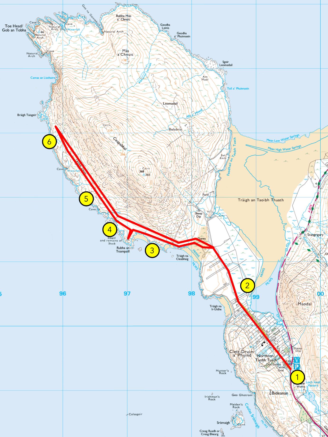
From Hebrides People Visitor Centre to Tràigh an Taoibh Thuath
Grade: A (A+ if extanding to Bolabrat)
Length: 4.5 miles/7km, about 1.5 hours
Terrain: vehicular road, then a gravel path, machair/grassland, sand and moorland
Wildlife: sea eagles, moorland birds like meadow pipit, stonechat, red grouse, wheatear and wrens, coastal birds like lapwing, greylag geese, kittiwake, herring gulls, oystercatcher, plover, shag and common loon
Guided Walk
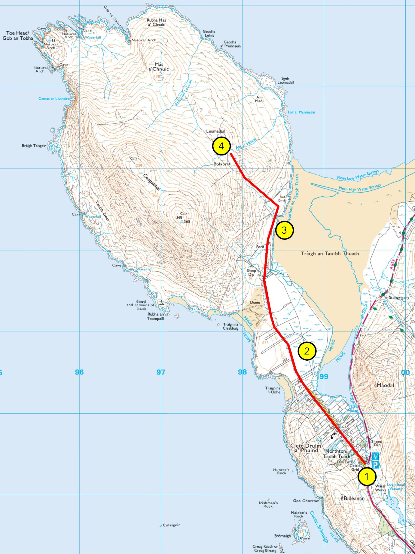
1. An Taobh Tuath / Northton
This township is known as An Taobh Tuath in Gaelic, and Northton in English. This is not where An Taobh Tuath used to be, and this area is still known as Druim a’ Phuinnd, the original name of this township. All the way to the end of the 19th century, An Taobh Tuath was actually located north of Ceapbhal, the mountain ahead of you, hence the name. It has moved from there southwards, to Druim a’ Phuinnd, taking its name with it. Another small settlement called An Taobh Deas, or the South Side, was located south of Ceapabhal. It is now strangely located north of An Taobh Tuath.
Keep following the road until you pass the gate to a rougher path on the common grazing.
2. Northton Machair
You are now crossing croft land. Most of what you see ahead of you is called cùl-cinn, or common grazing, and is shared by local crofters. Crofting is an important part of the social and cultural life of the Highlands and Islands, and while its economic value has decreased with changes in the lifestyle, it is still a form of survival agriculture to many indigenous families. This common grazing, located on the Northton Site of Special Scientific Interest, or SSSI, is particularly valuable as the sandy machair soil provides the animals with good grass rather than the poorer moorland soil found around the hills. Machair also makes for good planting ground, and while crops are now rarely seen in these parts, crofters elsewhere in the Hebrides do cultivate areas of machair. The word machair is Gaelic and was borrowed into English as most of the machair land in the world is located on the west coasts of Scotland and Ireland, which are historically Gaelic speaking.
You may see many birds among the sheep and cattle, not least of which the currucag, or lapwing. You will recognise it thanks to its crest and rounded wings, which make for a distinct flight pattern.
Continue onto the path to the north, sticking to the right as you reach the foot of the mountain.
3. Northton SSSI
The area around Tràigh an Taoibh Thuaith, the large tidal sand stretch north of the village, was designated as a Site of Special Scientific Interest for its machair, saltmarsh, and as a ground for breeding birds. Apart from the currucag, or lapwing, other species of birds will be around depending on the time of year, such as the golden plover, or feadag, and the oystercatcher, or trìlleachan. And if you keep an eye up towards Ceapabhal, you may even see the local family of sea eagles, the iolaire-mhara, the biggest bird in Scotland with up to 2.4m wingspan.
Keeping to the shore and being careful not to disturb the sheep and cattle, make your way to the Hut Circle.
The site you now stand on is home to several traces of human occupation. You certainly noticed the feannagan, known in English as lazybeds. They consist of a series of ridge and furrow and were common throughout Europe but are now mostly used by the people of Western Scotland and Ireland. This method allows to build more ground depth where it is irregular. In Harris, seaweed was added to the dirt to provide fertiliser. While now mostly used for potato crops, it was also used for barley, oats, and many other vegetables until a few decades ago.
There is also here an old dwelling site. While not as obvious today, a circle of prehistoric huts are found by the shore, their drystone walls being mostly overgrown but leaving marks in the ground. Scraps of Iron Age pottery, as well as a decorated bronze pin found on the site helped date it to at least the Early Middle Ages.
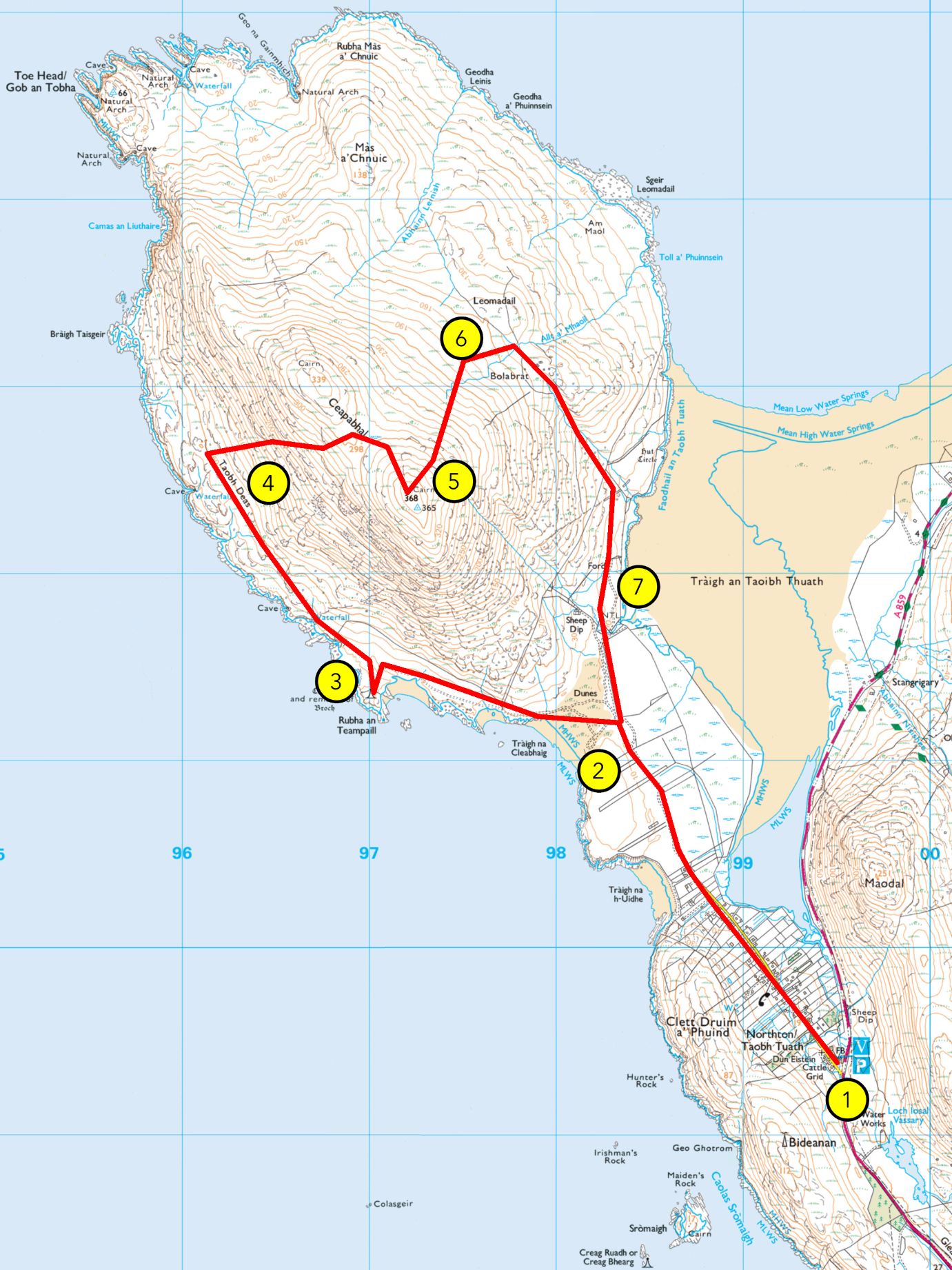
If you wish to stop the walk here, you can make your way back to Northton. If you would like to go farther, cross the fence to the north-west and go up the braes along the gully, until you reach the top of a knoll covered in green grass and ruined stone bothies.
4. Bolabrat
This higher ground on which you stand is home to several ruins, some along Abhainn Lèinis to the west, others at Leòmadail and Bolabrat, where you stand. The ruins you’ll see here are of small, round buildings in clusters. They are known as àirigh in Gaelic, or shieling in Scots and English. From at least the early Middle Ages all the way to the early 20th century, many communities in the Highlands and Islands used to practice what is known as transumance. In the summer months, villagers would take their cattle and sheep away from the winter pastures located around their homes, to the summer pastures in the glens and hills. It allowed for habitats to regenerate and for a more balanced exploitation of the environment. The distance between the villages and the summer pastures made hill shelters necessary, and that is why people built these huts, where they would sometimes stay for the whole summer. People would watch over the animals while making cheese, butter, and other activities. It was often a task for younger members of the community, and the shieling was an opportunity for them to get some freedom from older members of the family. Shielings often appear in Gaelic and Scandinavian folktales as liminal places where strange things happen, from murders to supernatural encounters. This is the last point of our guided walk and you can make your way back to Northton from here.