Walks

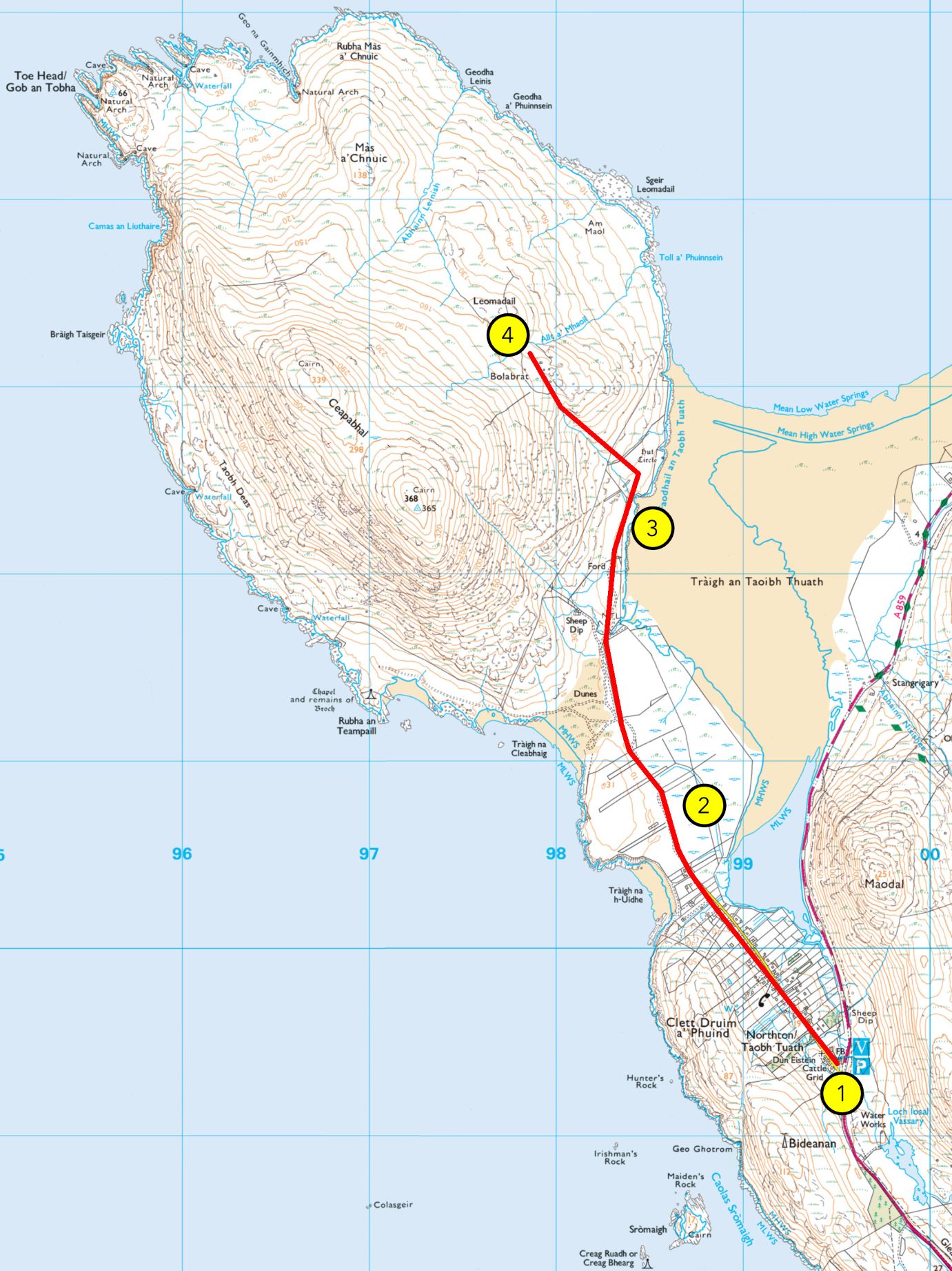
  • Topographic map showing a red route from point 1 (south) to point 4 (north), passing yellow circles 1-4 over peninsula terrain.

    WALK 4: TRÀIGH AN TAOIBH THUATH

    From Hebrides People Visitor Centre to Tràigh an Taoibh Thuath Grade:    A (A+ if extanding to Bolabrat) Length:   4.5 miles/7km, about 1.5…

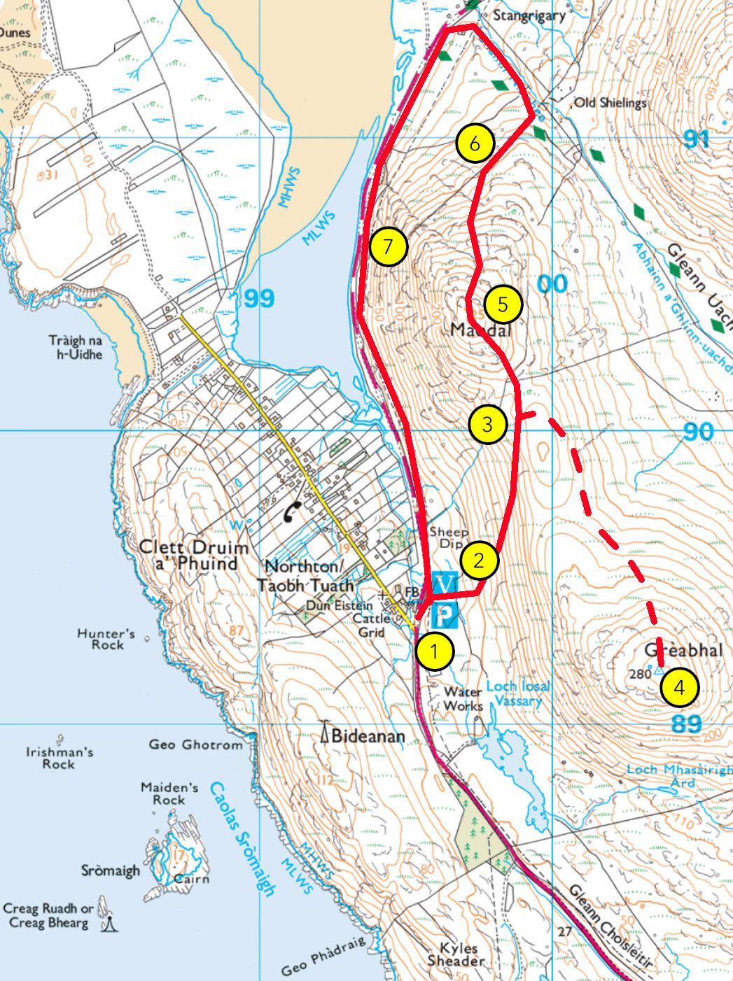
  • A topographic map with a numbered walking route (1–7) follows water and climbs a hill through North Tolsta, ending at Stangaigil.

    WALK 3: MAODAL (AND GREABHAL)

    From Hebrides People Visitor Centre to Maodal (and Greabhal) Grade: B Length: 3 miles (or 4 miles) / 4.5 km (or 6km), between 1.5…

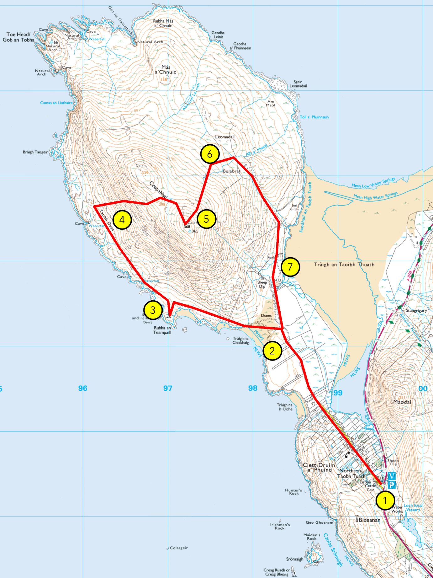
  • A topographic map with a red looped hiking trail on a mountainous peninsula, showing six numbered yellow points from coast to inland.

    WALK 2: CEAPABHAL CIRCULAR

    From Hebrides People Visitor Centre to Ceapabhal summit Grade: C Length: 7.5 miles/12km, about 4 hours Terrain:   vehicular road, gravel path, machair, grassland,…

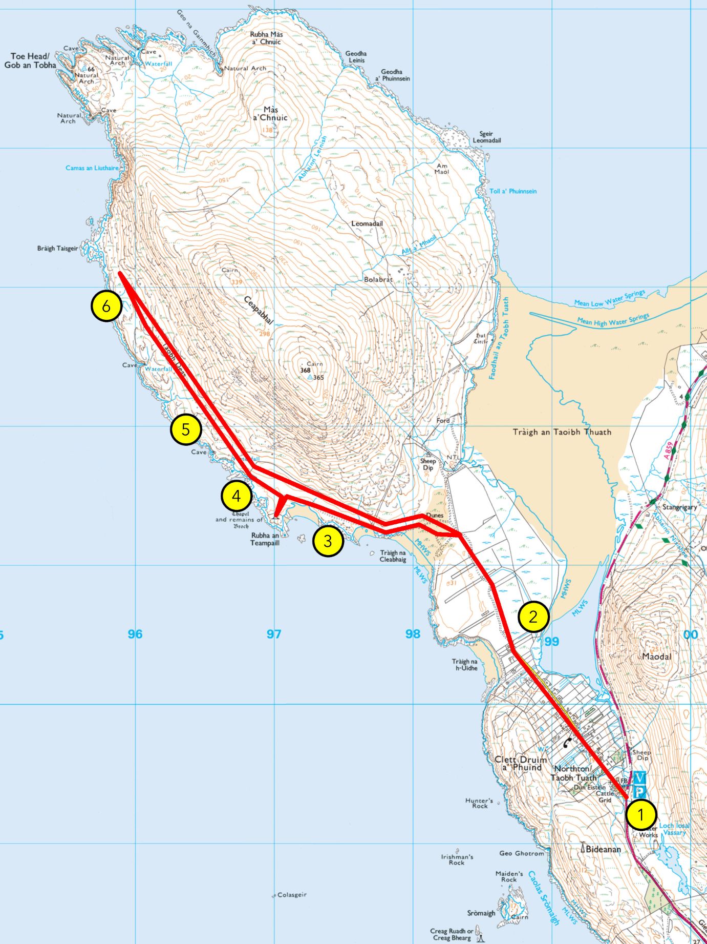
  • A topographic map with a red route from point 1 (southeast) to point 6 (northwest), crossing mountains and markers 2–6 along the coast.

    WALK 1: AN TEAMPALL AND AN TAOBH DEAS

    From Hebrides People Visitor Centre an Teampall (and Bràigh Taisgeir) Grade: B (A if stopping at an Teampall) Length: 7 miles (4.5 miles) /11km (7km),…

Tha toraidhean an stòr-dàta airson Hiort air fad an asgaidh, le taing dhan a’ Mhaoin-Dualchais. Thoir sùil air tasglann Hiort airson faicinn mar a tha an stòr-dàta ag obair!


On social…

Find Us

Contact Us

Hebrides People Visitor Centre
An Taobh Tuath (Northton), Isle of Harris HS3 3JA

///driftwood.ample.frail

01859 520258

info@hebridespeople.com

Our funders

Heritage Fund_Acknowledgement_Stamp_Scottish Gaelic_Teal
COSLA-Logo
comhairle-nan_eilean_siar-logo
uk_gov_logo
our_islands
hie-logo
scotgov-logo
Heritage Fund_Acknowledgement_Stamp_Scottish Gaelic_Teal
COSLA-Logo
comhairle-nan_eilean_siar-logo
uk_gov_logo
our_islands
hie-logo
scotgov-logo
Skip to content